BASS LAKE DAM HISTORY/INFO

CRANE VALLEY RESERVOIR
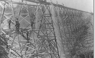
The original dam was built in 1896 and enlarged in 1910. The Sugar Pine Railroad used to cross the dam, bringing logging to Fresno. The Dam is actually two parts both basically earth (Hydraulic Fill). The long side, the one you see from most angles of the lake has no spillway. There is a water tower which allows for the regulated outflow to the generator and stream.
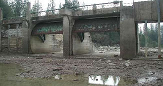
EAST SPILLWAY
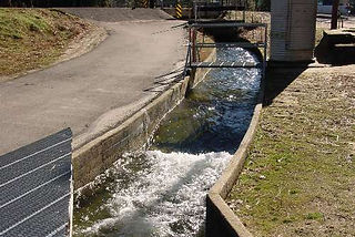
The other side is around to the East. It is where the spillway is located. The spillway is specially designed to allow high levels of water to flow down stream without damaging the dam.
SPILLWAY
The spillway has 2 moveable gates to regulate outflow. The height of the Spillway to the top of the gates is about 11.5 ft. The top of the gate is 3376.4 ft elevation.
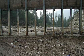
STEEL TRACKS
The steel tracks for the removable boards are specifically designed to effectively control water flow. These boards slide into position to retain water and are generally installed after April 1st, with their removal planned for November 1st. It is crucial to remember that they cannot be taken out while water is being held back. Although the spillway acts as an emergency safeguard for the dam, it usually does not permit water flow, since all outflow is meticulously managed the power station.
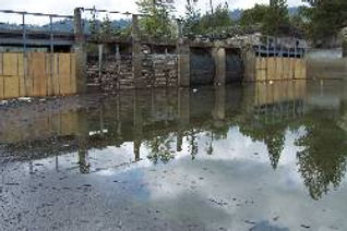
BOARDS & GATES
The Boards and the Gates are closed in this picture taken with the lake filling and only 3" of water pushing against the boards.
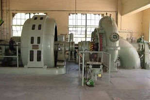
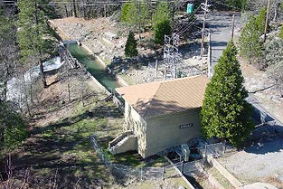
CRANE VALLEY POWER HOUSE
The Crane Valley Power House, at Bass Lake has a 900 KW Generator, installed in 1919. This is one of 5 generators on the San Joaquin River system producing about 28 MW's of power.
CRANE VALLEY POWER HOUSE CONTINUED
The power House as seen from the top of the dam. Water is diverted to either the creek or to another slue taking it to other generators. Water is always released into the creek to maintain the down stream habitat.
WATER SOURCES
Most of the rain and snow melt, run into the lake through the Falls located at the North West end. North Shore Road (rd 432) crosses over this creek called 'North Willow Creek' This creek is also the source of drinking water for the Pines Track & Falls Tracks
BROWNS DITCH
Another major source is Browns Ditch. This slue was added to increase the inflow when the dam was enlarged in 1910. The slue is located at the North Eastern side of the Lake. You can see Browns Ditch on Road 274 & Central Camp. Water fills the slue at a maximum rate of 75 cu/ft/sec from Browns Creek and South Willow Creek along with several other unnamed creeks.
OTHER WATER SOURCES
Many smaller streams also feed water to the lake.Willow Cove - Pines CreekLake Shore Cove - Salter CreekRecreation Point - Slide Creek